
GML Map Visualization on Mobile Devices
Mar. 2010. By Young-Sik Jeong
Keyword: Map visualization, DXF, DWG, SHP, GML, POI, Trace Monitoring
GIS can only be applied to certain areas by storing format. It is subordinate to a system when displaying geographic information data. It is therefore inevitable for GIS to use GML that supports efficient usage of various geographic information data and interoperability for integration and sharing.
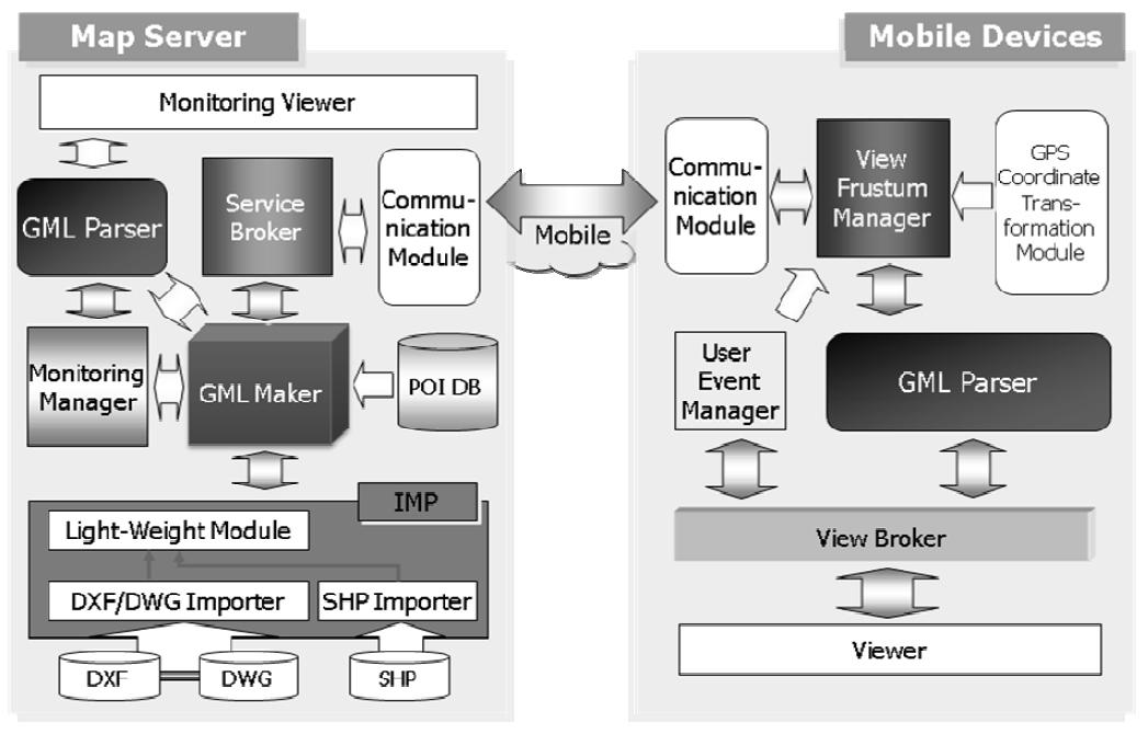
This research constructs VisualGML that translates currently-used geographic information such as DXF (Drawing Exchange Format), DWG (DraWinG), or SHP (Shapefile) into GML format for visualization. VisualGML constructs an integrated map pre-process module, which filters geographic information data according to its tag and properties, to provide the flexibility of a mobile device. VisualGML also provides two major GIS services for the user and administrator. It can enable visualizing location search. This is applied with a 3-Layer POI structure for the user. It has trace monitoring visualization through moving information of mobile devices for the administrator.